nature

Sunday Hike


Definitely need to take a tour of the mansion soon.

Riz and I are now hooked on Sony cameras

I believe horses are giant doggos. Beautiful creatures, I wish I owned one. 

Pablo looks serious in all his photos, but this is his true essence- he is a derpy dog!

I need me a black fur coat, his makes him look so much smaller than he is in person

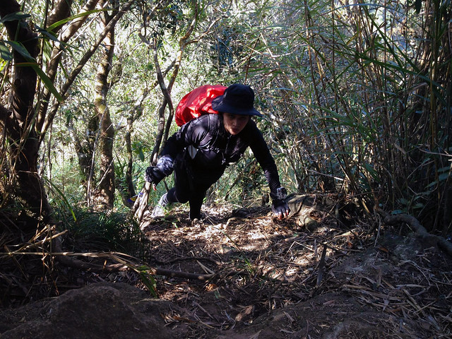
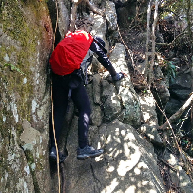
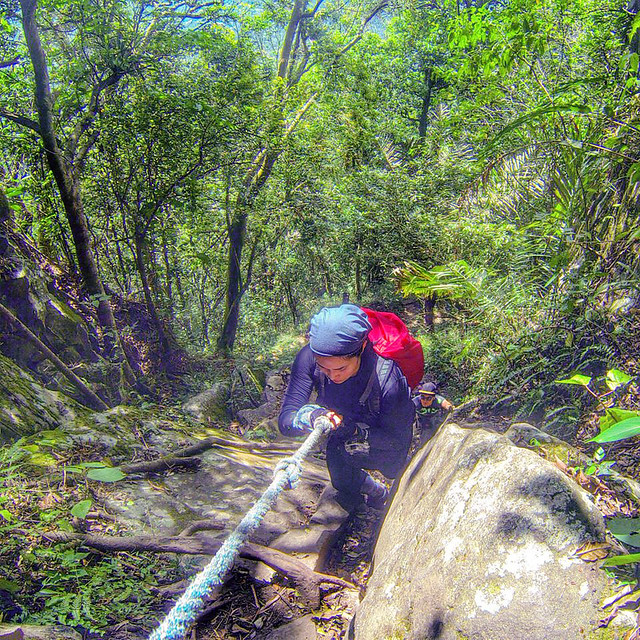
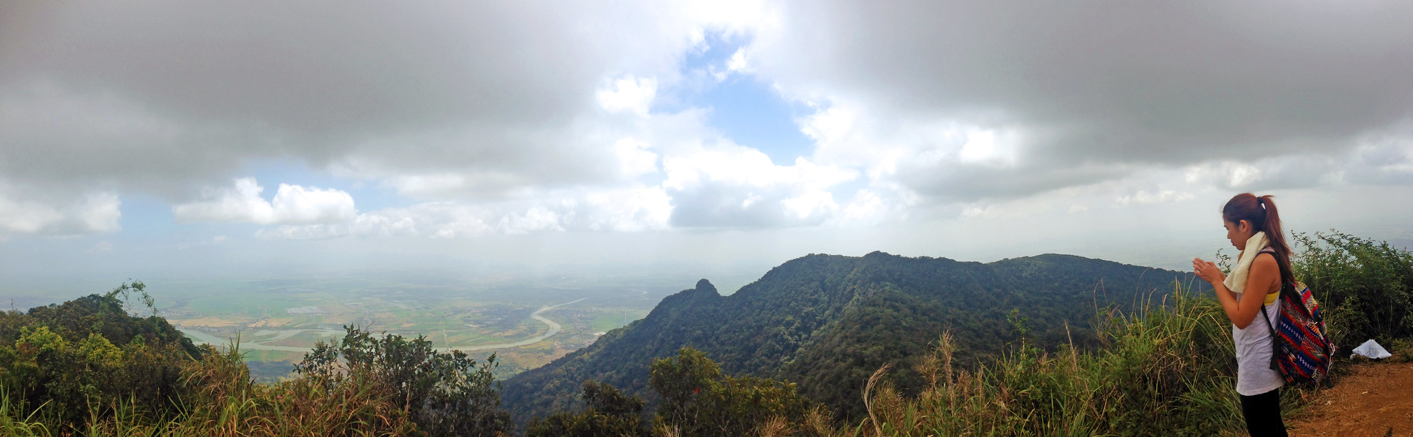
I couldn't find my hiking fanny pack in time so I used this Mochila I got from Latin Curated. It's from Najash by Sigrid Saenz and I love it. I am also in love with the way it smells, I wish they had the scent in a bottle! Each of their bags is one-of-a-kind and is handwoven by two indigenous Colombian communities Wayuu and Embera chami.


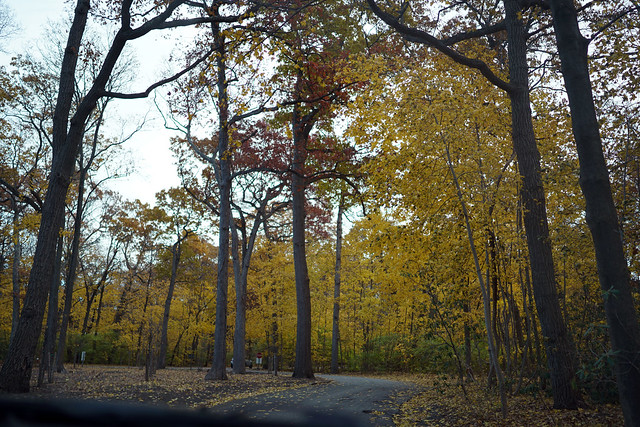
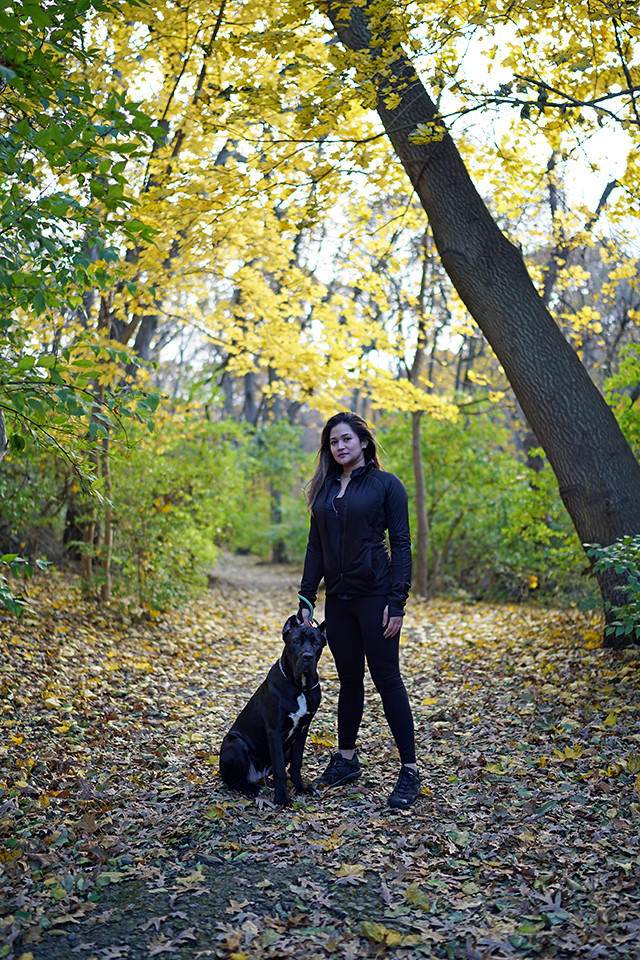
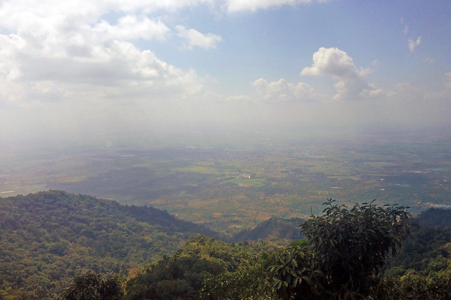
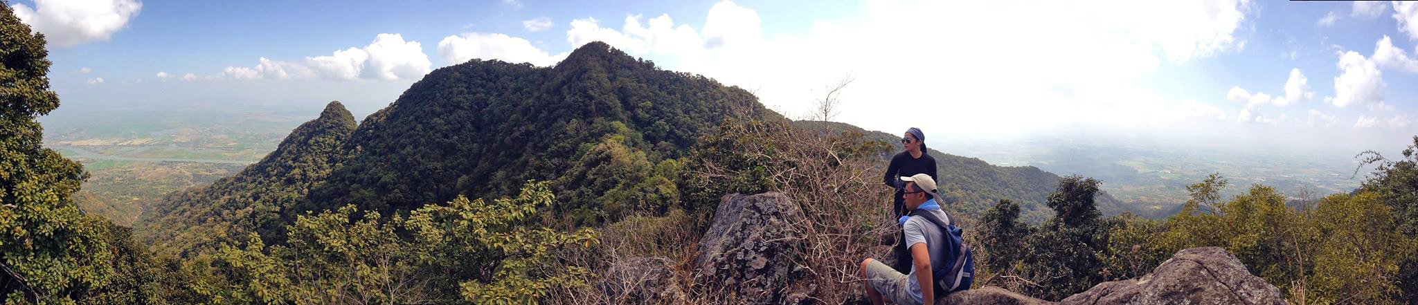
After almost a year of living in the 'burbs, it was our first time to hike at the Sands Point Park & Preserve. It was so close to our house and I regret not going sooner. It would have been the perfect spot for summer hikes as they have a lot of trails to choose from and the beach was a lovely site, too. We practiced Pablo's walk, pausing whenever he pulled on the leash and applying lessons we learned from his trainer. He also got to enjoy 30 minutes off-leash and played around the beach with his new friend Charlie. I try not to leave him off-leash unsupervised even in our own backyard since he's a puppy who loves to eat everything on the ground. As much as we wanted to stay longer to explore the trails, it was a bit too cold and we were underdressed. Living by the water does make the cold more brutal thanks to the wind. I can't wait to take more friends and family there. It's so peaceful and it makes me love living here more. I enjoyed so many mountains in the Philippines but it always took us 2-6 hours to drive to a new trail- through a combination of driving, bus, jeep and tricycle. 

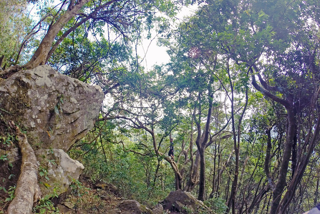
I am more motivated to post ever since I got a new camera! These photos are unfiltered and make me really happy that I bit the bullet and converted to an all-Sony gear. I am currently using the Sony A7Rii with a 35mm lens. 


Mt. Arayat- first major day climb [traverse]


This marked the fenced military camp just along the North Peak. 

[View larger version here]
After a few photos, we had lunch here and rested a bit. We then proceeded to Haring Bato

[View larger version here]
Taking a few photos by Haring Bato with a view of the South Peak and viewing deck


We then proceeded to descend going to South Peak. This 90° boulder was just the start of many tricky portions. We weren't expecting the technicality of the next part of the trail. 


No more photos of the climb up South Peak since it was a series of deadly 85° to almost 90° slopes. 


One last group photo before descending!


QUICK FACTS

Mt. ARAYAT (MAGALANG-ARAYAT TRAVERSE) 
(source)
Pampanga 
Entry point: Brgy. Ayala, Magalang, Pampanga 
Exit point: Brgy. Juan Bano, Arayat, Pampanga 
LLA: 15.2067N, 120.7441E, 1,030 meters above seal level / 3,379 feet 
Days required / Hours to summit: 1-2 days / 5 hours (North Peak) 8 hours (South Peak) 
Specs: Major climb, Difficulty 5/9, Trail class 1-4 (10kms)

ITINERARY (source) 0400 Assembly at Victory Liner Cubao EDSA south bound. Take bus passing San Fernando, Pampanga 0500 ETD terminal 0600 Alight at SM Pampanga 0630 Take jeep bound to Magalang 0730 ETA Magalang Jollibee, breakfast, take tricycle to Brgy. Ayala (jump off), register 0830 Commence trek 1200 ETA North Peak (summit), lunch 1300 Resume trek, head to South Peak via ridge 1400 ETA Haring Bato 1500 ETA South Peak 1530 Descent 1730 ETA Bgy. San Juan Baño, Arayat 1830 Take tricycle to bayan, then jeep to SM Pampanga 1900 ETA SM Pampanga, dinner/snacks/post-climb 2200 ETA Manila


EXPENSES

Bus: Cubao to San Fernando, Pampanga - P102
Jeep: San Fernando to Magalang - P35
Tricycle: Magalang to Bgy. Ayala registration desk (jump off) - 70/trip
Tricycle: Bgy. Juan Bano to bayan - P50/trip
Jeep: to SM Pampanga - P25
Bus: San Fernando to Manila - P102
Guide: he charged us P1,100- obviously overpriced for a group of 3!

(Piece of advice for hiring guides- agree to his fee before beginning your trek and haggle!) 


Ayen, Jed and I were quite impulsive when we decided to head over to Mt. Arayat a few Saturdays ago. I just quickly read the itinerary and list of expenses. Jed didn't even confirm he was joining us until he showed up at the terminal. We knew this was a "major" day climb but we proceeded even if we all felt like we weren't as fit as we always were during our other climbs. 


I had a hard time especially since my ankles were hurting a lot, but we managed to reach the summit on schedule. The trail consisted of a lot of boulders and roots. It resembled most parts of the climb to Tarak. 

This was the most challenging mountain to date. Jed said he found it harder than our scary experience in Tarak, having our tents wrecked and not sleeping a wink since we were at the wall of the eye of the storm during Typhoon Gorio. This isn't the hardest mountain to climb but we were shocked at the "buwis-buhay" part which was, true enough, deadly, on the way to South Peak. We scrambled through 85°-90° slopes and was holding on for dear life just to advance. Ayen would signal me when to go and I would signal Jed just to make sure we weren't eating dust while going up. There were no roped segments and if you slipped, well.. goodbye. We had to make sure that each branch and root was sturdy enough for us to grab on to. We didn't take photos during this part (most of our afternoon) since "we were busy trying not to die" (Jed, LOL). 

Overall, we really appreciated the challenge. We loved it more than the beautiful view since we felt like it was the real deal! The other climbs we've done are chicken sh*t in comparison. Not that any of them were easy- you have to be fit to climb, you don't climb to get fit! This is a great mountain for those with a bit of experience since it takes 8-9 hours (traverse). Hire a guide if it's your first time since the landslides are constantly changing the trails. 

Mt. Maculot day climb (traverse)


I'm livin on the edge!!! 

Check out Steph lounging on the rockies. Just check out that breathtaking view! 

YOLO 

With some new members of RMC! Clockwise from the back- Marco, Eslav, me, Steph, Miki, Ayen and Jovic. 

Posing with Steph cos they wanted to compare the inappropriate vs. appropriate climbing outfits. We actually just hated her cap. :)) 


MT. MACULOT 
basic facts from Pinoy Mountaineer
major jumpoff: Mountaineer's Store, Brgy. 7 "Siete", Cuenca
exit point (traverse): Brgy 5 (to Grotto), Cuenca 
LLA: 13°55 N; 121°2 E; 706 MASL (Rockies) / 930 MASL (summit) 
days required / Hours to Rockies / summit : 1 day /  2-4 hr 
specs: Minor, Difficulty 4/9 (Traverse) Trail class 1-3. 
features: Scenic views of Taal Lake, rock formations, forests 


We finally got to climb another mountain last Saturday and we chose Mt. Maculot in Cuenca, Batangas. There was a tragic bus accident again the night before so we decided to take our own cars and just contribute to the gas/toll money. Usually buses are more convenient since we get really tired after each climb but we figured a 2.5-hour drive from the city to Batangas wasn't too bad.

Decided to start our journey through the grotto which was really a challenge for me. I felt like having an asthma attack throughout the 15 stations of the cross made of concrete stairs but I'm so glad I didn't! I just recovered from 3 days of having a fever, colds and cough so I was being really slow. None of us slept the night before as well. I'm just glad I made it through that without fainting. ALSO, I discovered my trekking shoes shrunk! I felt my right foot was a bit squished when I put them on at home and as I went through the hike I slowly felt my feet giving up on me. I shouldn't have given them to my sister's yaya after my last hike- letting them dry out under the sun shrinks the leather and that waterproof layer in between so you're supposed to go half a size up when getting new trekking shoes. Oops. It was the most painful climb ever so don't do what I did!

The trail wasn't bad at all. There were just too many burs along the way that kept sticking to my cotton leggings, headband and sleeves so I had to take them out every few minutes. There were two roped segments (that proved the rope wasn't too useful) and a lot of sections that required holding on to tree branches and roots just like most climbs. There are a few flat trails which makes it a level four climb, so it wasn't too easy nor too difficult.

The first part took us about 3.5 hours. After lunch and resting for an hour at the camp site, we proceeded to the rockies. The view was AMAZING! Pretty sure you can see just how thrilled we were in the photos. Those moments make the gruelling climbs really worth it! If we had planned to stay overnight I would've stayed on the rockies til sunset. I'm doing another Mt. Maculot trip for sure!